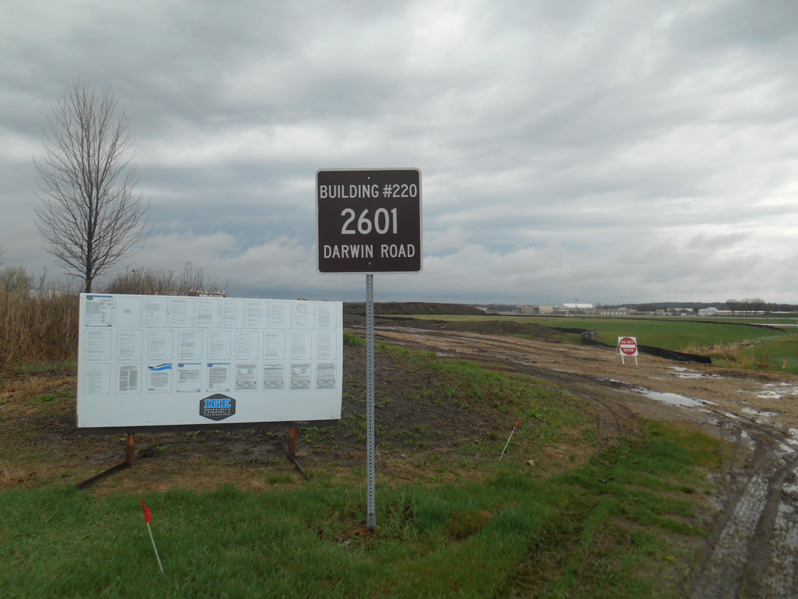
PHOTO: Former Dane County airport fire pit being excavated to build a parking lot in May 2018.
The County, City, DNR and DoD were aware of the contamination for at least 30 years, but took no actions to clean it up
****
Fire-training areas or “burn pits” where aqueous film-forming foams (AFFF) were used by firefighters to practice extinguishing fires have been found to have extremely high levels of toxic PFAS (per- and polyfluoroalkyl substances); see here, here and here (more details in footnote)[1]
There are two burn pits at Dane County Regional Airport (DCRA). One burn pit at 2601 Darwin Road (see photos here) was used from 1953 (possibly earlier) through 1987 by the Truax Air National Guard (ANG), Air Force, Army, Dane County and City of Madison fire departments. Another burn pit and fire-training area, southeast of the airport at 1750 Pearson Street (see photos here), has been used by Truax Air National Guard, city and county fire departments, and the MATC fire training program.
Details about who used the 1750 Pearson Street burn pit, and when they used it, are murky and contradictory. A recent press release from the Madison Water Utility stated that “a second pit on the east side” of the airport (presumably referring to the 1750 Pearson burn pit) “was used about a dozen times from 1989 to 1993,” but doesn’t say who used it then. A 2015 Air National Guard report says they “historically” used the MATC fire-trianing area. MATC clearly still uses its fire training area at this address, and on January 15, 2019 (when I took the photos linked above) Madison fire trucks were at the site training.
How contaminated with PFAS and other contaminants are the two Dane County burn pits now? What about Starkweather Creek?
A 1989 investigation by a Department of Defense (DoD) consultant found a range of highly toxic chemicals, including significant levels of chlorinated solvents and petroleum compounds, in soils, groundwater, and surface water at the Darwin burn pit. It was never remediated. Petroleum compounds were also found at the 1750 Pearson burn pit in the late 1990s. DNR approved closure for the site in 2004, but details of the extents of these investigations and remediations are unclear, since the DNR BRRTS link for the site does not include all the documents listed.
PFAS compounds have never been measured at either site—or if they have, the results haven’t been shared publicly.
Starkweather Creek goes around both burn pit areas, traveling just feet away from them before flowing into Lake Monona a couple miles south. All the storm drainage from the burn pits goes into the creek.
Neither the City nor the County is taking responsibility and promptly investigating PFAS and other contaminants leaching from these burn pits into Starkweather Creek, its fish, people who eat the fish, and Lake Monona.
Instead, in back-room meetings in July, with DNR approval city and county officials decided to hand off responsibility for these county-owned sites to the U.S. military. The Wisconsin Air National Guard’s July 31, 2018 letter to DNR offered to take over investigations at these sites—on their terms and their timeline—and Mayor Soglin and Michael Kirchner, Dane County Airport’s Director of Engineering, agreed. Undoubtedly, city and county attorneys helped craft the deal.
As far as we can tell, most local elected officials are in the dark about these back-room deals. Other than a few of us, citizens are also unaware.
What is going on? Who does this arrangement benefit? Who is protecting whom?
For more details, here is a rough Dane County fire pit history…
Early in 2018, while researching what kinds of contaminants might be leaching from the Truax ANG into Starkweather Creek for our EPA-funded environmental justice project, MEJO came across the following in the 1988 “Preliminary Assessment,” part of the U.S. Department of Defense “Installation Restoration Program” (IRP):
“The area used for fire training exercises by the ANGB is located on the east side of International Avenue at Darwin Road. The site consists of a rectangular open earth area, approximately 600 by 800 feet. There is no lining or containment structure for the area. This location has been used by the ANGB since the early 1950s in conjunction with other agencies over the years for various fire training exercises. The fire training area is not located on current ANGB property. It is currently owned by Dane County. Fire training exercises have been discontinued at the site since August 1986. At that time, the director of the Dane County Municipal Airport/Truax Field ordered a halt to all training exercises until an assessment could be made as to the environmental consequences of continued training exercises.” (pg. 39 of pdf, highlights added).
While subsequently reviewing a DNR file on the contaminated former Burke sewage treatment plant site south of the airport, in March 2018, I stumbled upon some of the results of the assessment the airport director asked for in 1986—in this 1988 Truax Field consultant investigation report. A map on pg. 7 of this report depicts the location of the fire training area referred to above (along International Lane just south of the airport, at the intersection with Darwin Road).
The 1988 report was a draft, but just last week I obtained the 1989 full final report for the site from DNR. The “Investigation Report, Contamination Evaluation, Truax Field” included the Truax landfill and former Burke sewage treatment plant south of the airport. It was done by Envirodyne, consultants for the Army Corps of Engineers.
The investigation was part of the Defense Environmental Restoration Program (DERP), intended to “identify and remedy environmental problems at facilities formerly owned and operated by the DOD.” The DOD entities that operated on the site (Army, Army National Guard, Air Force/Air National Guard) used the Truax Field landfill, former Burke sewage treatment plant, and burn pit areas since the 1940s for disposing of military sewage and toxic wastes, and for fire training. The City of Madison and Dane County also used the landfill, sewage treatment plant, and burn pits at various times.
In 1988, during the site inspections that kicked off the investigations, the Army Corps consultants met with the Dane County Airport Director, City of Madison Principal Engineer, and Dane County Public Works Director to help identify areas most likely to be contaminated—one of which was the fire-training area. At that time, as is the case now, Dane County owned most of the Truax Field land. Through 1974, the city owned part of it.
In doing this report, DERP followed Comprehensive Environmental Response, Compensation, and Liability Act (CERCLA, or Superfund) regulations, which require investigators to score sites on the “Hazard Ranking System” (HRS). Truax Field received a high enough HRS score (primarily based on the trichloroethylene (TCE) in deep groundwater and petroleum compounds at the former sewage plant) that it should have been considered on the National Priority List (NPL) for Superfund. But it never was. Why not?
What happened at the International Lane/Darwin Road burn pit?
An excerpt from the 1989 report describes how the Darwin Road burn pit was used:
“The burn pit is located about 200 feet north of Darwin Road and 400 feet east of International Lane...According to Mr. William Skinner, Air National Guard Fire Chief, the area was used for fire-fighter training during the period 1953-1987. It may have been used prior to 1953. It is believed to have been constructed by the DOD. Training exercises were conducted by U.S. Air Force personnel during the 1950 ‘s and 1960 ‘s, by the Air National Guard, and later by the City of Madison, Dane County, and volunteer fire departments. Mr. William Skinner estimated that fire training took place ten to fifteen times per year.
Flammable liquids such as JP-4 jet fuel, kerosene, gasoline, diesel fuel, waste oil, and probably solvents and hydraulic oil were burned. Paints may have also been burned here by the City of Madison. On each day that training occurred, 500 to 1000 gallons or more of liquid were used. It was spilled onto the ground, ignited, and then extinguished. Several fires were started and extinguished each day. The fuel remaining after training exercises soaked into the ground, evaporated or was carried away by surface run-off. It appears possible that some may have entered the creek 400 feet to the east, The practice was terminated in December 1987. The Burn Pit Area is irregularly shaped and has dimensions of about 200 feet by 100 feet. The area was blackened and void of vegetation. Some standing water was noted in July 1988. The area is a former swamp and has a shallow groundwater table. It appears from surface stains that surface runoff from the Burn Area migrates to the south.”
The 1989 final Truax Field report included a hand-drawn map depicting the location of the burn pit in relation to Starkweather Creek, and the following information about the contaminants eventually found there:
“Groundwater near the practice burn pit (Site TG-3) was found to contain numerous organic chemicals present in fuels or solvents, and elevated levels of petroleum hydrocarbons. During installation of TG-3, cuttings from a depth of 24 feet exhibited elevated organic vapor meter readings and the odor of petroleum was noted. During well development and sampling, water in the well exhibited a strong solvent odor.”…“A sample of standing water in a ditch near the practice burn pit (TW-3) was found to contain organics present in fuels or solvents (including methylene chloride, benzene, toluene, 1,2-transdichloroethylene, thiobismethane, and tetrachloroethylene) Petroleum hydrocarbons and lead were also found in TW-3. These analytical results further confirmed groundwater and soils analyses which are evidence of contamination related to the practice burn pit.” (pg. 1-2, 1989 report).
PFAS was not investigated at the site in 1988-89. Though by this time, industries producing PFAS had already found evidence of serious PFAS toxicity (PFOS in particular, used in military AFFF), and the U.S. Navy was aware by the 1970s that AFFF could cause environmental problems,[2] it is unclear whether other military entities were aware of this then.
On November 29, 1990, DNR’s Carol McCurry wrote to the Wisconsin Air National Guard asking about ongoing contamination investigations at the base, and raising questions about the 1989 Envirodyne report:
“In addition to the underground tanks and the spills referred to in ‘the above mentioned report, other areas of concern exist. These areas are identified in a March, 1989 entitled, “Engineering Report Contamination Evaluation Truax Field Madison, Wisconsin”, prepared for the U.S. Army Corps of Engineers, by Envirodyne Engineers, Inc. In particular, the areas identified as the ‘burn area’ and the ‘JP4 tank area’ are of concern to the Department. The Department is unclear about the relationship of these areas to WANG activities. What agency has responsibility for completing the investigation at those sites?” (highlights added)
I never found any response to McCurry’s 1990 question. The DNR later investigated the “JP4 tank area” (jet fuel tanks), but other than the 1988-89 report, in 2018 I found nothing more in any DNR or ANG files about this “burn area.”
Zoom to 2018
On February 14, 2018, I obtained the Dane County Airport’s most recent DNR stormwater permit and Stormwater Pollution Prevention Plan (SWPPP). Neither mentioned the burn pits, PFAS, or many of the documented toxic contaminants at the airport and military base.
In April, 2018, we obtained the December 2015, Truax Perfluorinated Compounds Preliminary Assessment Site Visit Report. It said: “Based on this PA investigation, there is no evidence that a FTA was located within the property boundaries of the Base. According to Base personnel, the FTA at Madison Area Technical College (MATC) has historically been used by the WIANG Fire Department (FD). The MATC is located south of the Base.” (pg. 7) (this is 1750 Pearson).
On May 4, 2018, I drove out to the airport to take some photos of Starkweather Creek for our MEJO EPA EJ project. I noticed that the former Darwin Road burn pit right next to the creek was being excavated for a new airport parking lot. See photos here.
On May 7, 2018, DNR posted the March 27, 2018 Truax site investigation report on BRRTS. It didn’t mention the MATC or the Darwin burn pits. However, the same day, DNR’s Mike Schmoller sent a letter to the ANG that said “Wisconsin Air National Guard staff are known to have used the county fire fighting training area at 1750 Pearson Street. There are concerns about perfluorinated compound impacts to the soil and groundwater at this location. Field work for this potential release area needs to be added to the workplan.”
On May 9, 2018, I emailed DNR Remediation & Redevelopment asking the agency to identify all sources of PFAS to Starkweather Creek and informed them of the excavation of the highly contaminated Darwin burn pit–which they seemed to have no prior knowledge of.
I wondered if the airport had the appropriate stormwater permits for this excavation and construction right next to Starkweather Creek. So I queried the city, county, and state.
On May 10, 2018 Greg Fries from City of Madison responded to my query: “The burn pit you refer to is old – not sure what they are doing up there now but generally if it is on the airport proper… they are not required to obtain a permit from the City as they operate under Trans 401 permits (more like letters of permission) from the WDNR.”
On May 18, 2018, in response to my May 11 email to DNR asking about any permits relevant to the DCRA parking lot excavation, a DNR open records person, Hayley Stroik, sent me the WPDES construction permit for DOT activities, issued April l, 2018.
On June 7, 2018, County Supervisor Michele Ritt obtained a June 12, 2017 DNR Final Concurrence” letter per the DOT/DNR Cooperative Agreement from airport officials. The letter said that 1.58 acres of wetland had been filled in for the project.
On June 13, 2018: I queried Eric Heggelund at DNR asking for a map of the location of the parking lot excavation, and what was on the site before the excavation. He directed me to Matt Messina from WisDOT Bureau of Aeronautics.
On June 14, 2018: Matthew Messina wrote me: “Attached are the soil borings and layout map. I’ve also attached the environmental document that describes the area and associated impacts.”
The same day, I responded: “This appears to be right where the former burn pit area was. Soils and groundwater in this area were found to be very contaminated in the late 1980s. Do you know if they were they ever remediated? He replied: “I was not aware of the pit, but I talked to the airport and here’s what I found out. 1. The burn pit was the Department of Defense’s. Because of this, neither the DNR, the airport, or DOT has any records on the pit. DOD should have remediated the site as it is part of their process. 2. Based on aerial photography. The pit was not in the area of the new parking lot. Do you have any records regarding the pit?” I sent him the 1988 Truax Field report I had with the map of the fire pit and contaminant data.
He later sent me his map of where he thinks the burn pit was. Based on hand-drawn map in 1989 document, however, and soil staining in satellite photos, this doesn’t seem correct.
The above exchanges and documents reflect confusion related to the fact that EPA told DNR in July 2011 that they could no longer exempt DOT facilities like the airport from stormwater WPDES permitting. It took time for the Wisconsin Legislature to change regulations in response to this. DNR eventually issued a WPDES DOT construction stormwater permit that covered DCRA on April 1, 2018 (link above). The plans for the DCRA parking lot excavation/construction over the former burn pit began the before this permit was issued, apparently covered by the June 12, 2017 “Concurrence” (link above).
Confusion aside, I found nothing in any of the documents or communications I obtained (linked above) indicating that anything was done before or during the parking lot excavations and/or construction to investigate the toxic contaminants at the burn pit site or control their release into adjacent wetlands and/or Starkweather Creek.
Thirty years later, no remediation has been done at the Darwin burn pit
On June 18, 2018 (unbeknownst to me, but prompted by my queries and documents), DNR’s Michael Schmoller sent Madison Mayor Paul Soglin, Captain Matthew Shaw from the Wisconsin Air National Guard, and Michael Kirchner, Director of Engineering at Dane County Regional Airport a letter noting that the fire pit south of the airport “has been the location of past firefighting training activities potentially using PFA foams. The Department believes you and other past owners or users of the property may potentially be responsible for causing or contributing to the PFA contamination. The Department is sending this letter to request that you and the other identified patties conduct a soil, groundwater and surface water investigation at the site this summer. The study should describe the full nature and extent of PF A contamination, if any, in preparation for conducting any necessary remedial actions. The Department is willing to assist in developing a site investigation work plan. Within 45 days of receipt of this notice, please provide me with a letter confirming your intention to conduct the field study.” (highlights added)
The letter says nothing about investigating the documented toxic contamination (other than PFAS) at the site. MEJO has repeatedly asked city, county, and DNR officials about testing for other contaminants there, and elsewhere in Truax Field, but our questions have been ignored or dismissed.
On July 2, 2018, the DNR wrote me, in response to my questions about the burn pit: “We have checked our files and determined that no remediation has been performed in this area and no testing of PFAS has been conducted. We have issued a potentially responsible party letter to the Dane County Airport, the City of Madison and the ANG requesting that the site be investigated and, if necessary, remediated.” (highlights added).
However, some time between June 18 and July 31, ANG, DNR, city and county officials, and attorneys from all entities, apparently met and came up with a different plan than the one outlined in the June 18, 2018 DNR letter (above).
A July 31, 2018 letter to DNR (Schmoller) from Matthew Shaw of the Truax Air National Guard said that the National Guard Bureau (parent of all Air National Guard bases) would take responsibility for both burn pits even though neither is on ANG land. Mayor Soglin and Airport Engineer Kirchner signed the letter in agreement with the plan.
On November 28, 2018 (WU): Prompted by queries from the Wisconsin State Journal, realizing a news story about the PFAS issue was forthcoming, Mayor Paul Soglin sent a letter to Captain Shaw of the Wisconsin Air National Guard asking that the Guard prioritize further study of PFAS migration off the base and initiate environmental remediation. Mayor Soglin released the letter to the public along with the latest information about PFAS contamination near the base. This letter did not include anything about the July 31 letter re NGB taking over the burn pit investigations.
On December 9, 2018: Wisconsin State Journal published a story about PFAS.
On December 12, 2018: Dane County Airport Commission discussed the PFAS contamination at Truax for the first time (under the generic agenda item, “environmental matters update”). Three citizens, including me, attended. After giving a brief introduction about PFAS, Airport Director Kim Jones mentioned that after the June 18 potential RP letter was sent to the city, airport, and ANG (asking for burn pit investigations), “There were some meetings held, and the Guard agreed to conduct those additional studies” and “a letter was returned to the DNR, signed by the Guard, by Mike Kirchner who is the airport’s engineer, and by the Mayor, stating that the Guard would take on this responsibility.” Further, she noted that “on completion of those studies, we’ll all work cooperatively to resolve any of the issues that are identified.”
On Jan. 2, 2019: At my request, Kim Jones sent me the letter she referred to.
What is going on?
The burn pit history, arrangements that National Guard Bureau will take over the investigations, and the City and County approval of this, raise many questions:
-Why is ANG taking over these investigations even though these burn pits are not on the base?
-What did county and city officials do with the findings of the 1989 Truax Field investigative report, if anything? Why were these reports buried?
-Who was found to be responsible for the burn pit after DNR’s 1990 letter posing this question?
-Why was the Darwin burn pit area never remediated?
-Why was this site never regulated by DNR under Remediation and Redevelopment?
-Why was Truax Field never put on the Superfund National Priorities List?
-Why aren’t the many other toxic contaminants (besides PFAS) at the burn pits being assessed?
-Why won’t DNR put documents from these burn pit investigations onto the BRRTS site so the public can access them (as we were told more than once by government officials would happen)?
Are government entities covering for others or are they all protecting each other?
° Dane County owns the land in question.
° The military leases the land and is responsible for a significant portion of the contamination in many parts of Truax Field.
° The City of Madison once owned the land and is also responsible for some of the contamination over many decades.
° The County and City have authority through city and state regulations to require testing of contaminants that enter its stormwater system. Of course, the County also holds a stormwater permit jointly with the Air National Guard. Is this a conflict of interest?
° All these government entities have been discussing who was responsible for what and when, attempting to discern/limit liabilities. Does allowing the military take the lead on testing lead to limited or no liability for local government?
And the public—until now—has known nothing about this.
[1] At the former fire-training burn pit at Wisconsin’s Fort McCoy that hadn’t been used since 1992 (according to the military), combined PFOA and PFOS levels were as high as 72,400 ppt in 2016—and at another burn pit nearby that is still in use, levels were as high as 120,650 ppt. These levels don’t include the significant levels of other types of PFAS found there. (the EPA’s “health advisory” level for PFAS is 70 ppt).
This study of a military fire pit abandoned 20 years prior found total PFAS levels in the millions of parts-per-trillion (ppt).
[2] See here and here and here—from Sharon Lerner’s excellent piece “The Military is Spending Millions of Dollars to Replace Toxic Firefighting Foam with Toxic Firefighting Foam.”
