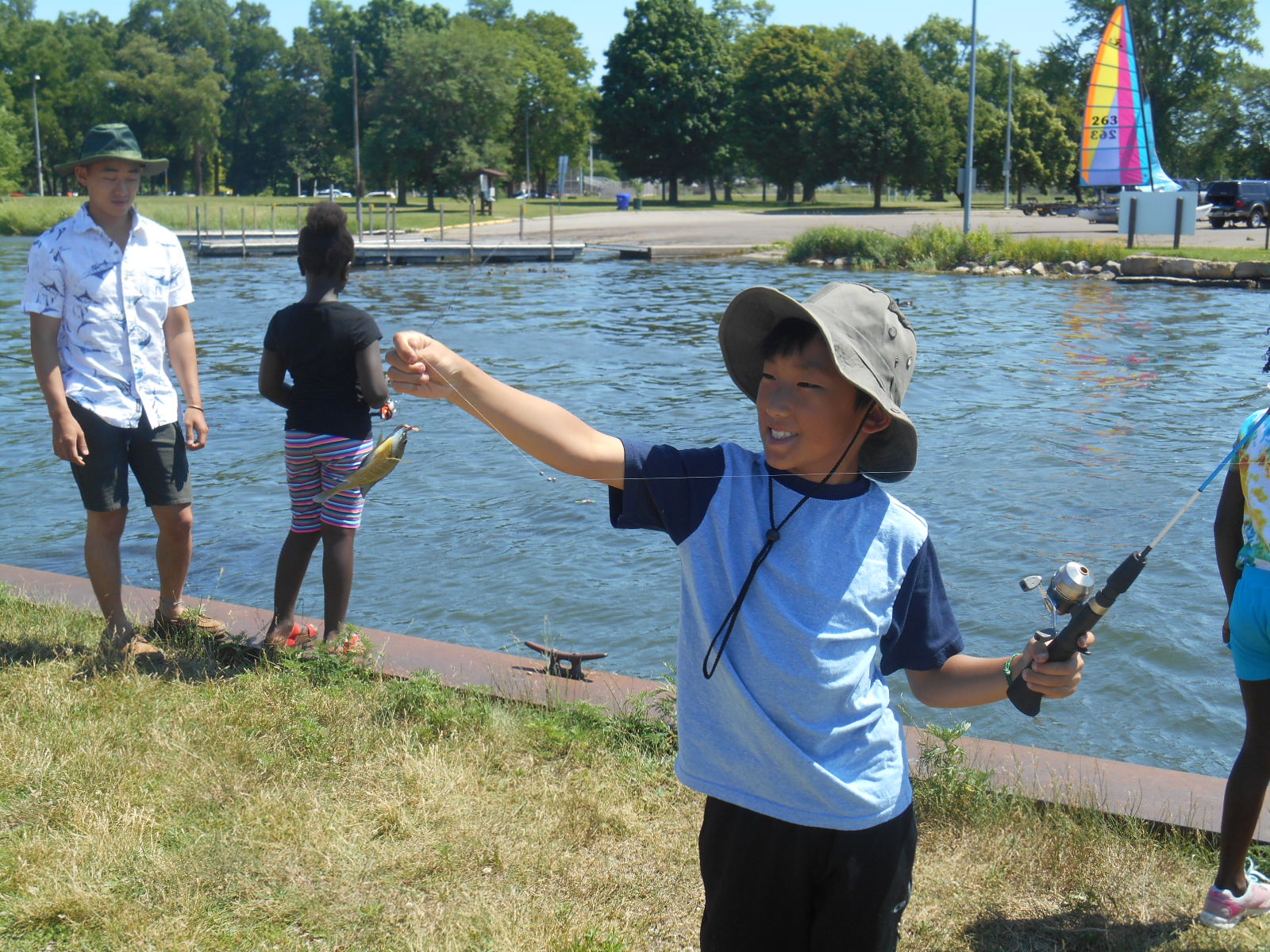
Above: Eric Xiong from the Truax apartments fishing at Starkweather Creek where it enters Lake Monona in Olbrich Park (Photo, Maria Powell)
This story has been updated from the previous version; links to data were added, PFAS units corrected.
Fish PFAS advisories released last week for the Yahara Lakes were shaped by Madison’s classist and racist history.
PFAS levels are significantly higher in Lake Monona fish than in Lake Mendota and Lake Wingra fish.[1] Lake Monona’s fish are now on advisory for PFAS, Lake Mendota’s and Lake Wingra’s are not (see summary of data here and full data here).
Paralleling the fish data, Lake Monona and all the downstream lakes have significant water PFAS levels–much higher than Mendota and Wingra levels. See map here.
Who is most exposed to Lake Monona’s toxic PFAS–and least likely to be aware of it? Shoreline anglers, including many people of color and low income people who rely on this fish as a food source. In addition to local anglers of color, especially Hmong, many African Americans travel frequently from Milwaukee and other nearby cities to fish on Lake Monona, which has more publicly accessible shoreline than Lake Mendota. Many take fish home to share with families (including pregnant partners, children, infants) and friends.
Problematically, Wisconsin has issued only “one-size-fits-all” advisories that do not include special advicie for “high risk” groups (infants, children, pregnant women, nursing mothers, and women of childbearing age). New Jersey recommends that these groups not eat any fish with over 17 ppb PFOS. Nearly all of the fish tested from Lake Monona and the lower lakes significantly exceeded this (while all but a couple of the fish in Lake Mendota and Wingra were well under it).
The highest PFAS levels in fish–up to 180 ppb (180,000 ppt) PFOS–were found in the lower part of Starkweather Creek in Olbrich Park just before it enters Lake Monona–a popular shoreline fishing location (depicted in the photo above). The creek is highly PFAS contaminated from the airport to the lake.

Madison’s race, class disparities embedded in our history—and our lands, waters, fish, and people
Wealthy European Americans and the U.S. government forcibly, violently removed Ho-Chunk Indians from the Yahara Lakes area in the early and mid 1800s because they wanted this beautiful place–which they described as a “paradise” and “veritable Garden of Eden”–for speculation and development, their own expensive homes, the university, and the state capital. Resorts popped up along the lakes, and wealthy people traveled to the area to enjoy the lakes and drink pure artesian water from the deep aquifers under the city (well, until they were poisoned).
After its founding, Madison was purposely segregated by class in the early 1900s, following years of debates among city leaders about whether the city should be a resort and university town or whether it should welcome sooty, ugly industries.
Eventually, city leaders struck the “Madison compromise,” creating “two Madisons.” Industries would be allowed on the east side, not the west side. Factory workers—including many immigrants and people of color–would live in flats, small inexpensive homes built for workers (and sometimes makeshift shacks in slums along the railroads) near their factory jobs on the swampy east side. University professors, doctors, and lawyers—mostly white people–would live in large single family homes on the higher, hilly west side near the university and hospitals. Zoning codes reflected these planning choices.
So heavy industries were built on the east side, often on filled wetlands. A series of inadequate city sewage plants were built on the east side. The airport and military base were built on the east side. East side landfills, some on the lake shore, took their burgeoning wastes. Workers, low income, and people of color living on the east side were exposed to the stew of chemicals around them from these operations.
Increasing amounts of industrial wastes, landfill leachates, oils, metals, pesticides and sewage sloshed into Starkweather Creek–which basically became a stormwater ditch–and then Lake Monona. Though DNR didn’t start measuring them till 2018–due to our ongoing advocacy–PFAS compounds were in this toxic sloshing mess since the 1940s (they were first created around WWII and used in A-bomb creation during the Manhattan project; after the war their use skyrocketed in Teflon pans, numerous consumer products, industrial applications, firefighting foams and much more).
When local fire departments, and airport and military base firefighters began using PFAS-based firefighting foams in the 1950s and 60s, this added substantially to the PFAS in the the toxic stew flowing to the creek and lake. Beginning in the 1950s, city, county, and military firefighters trained at “burn pits” on county land right next to the creek, where they sprayed PFAS foam on the ground many times a year.
PFAS are known as “forever chemicals” because they last so long in the environment. They will be in Starkweather and Lake Monona sediments forever, cycling up into fish, wildlife, and people, where they can build up to very high levels.
As we have asked countless times–ad nauseam–over the years: When will Madison and county leaders take steps to clean up the fire pits they used since the 1950s, instead of waiting for the U.S. military to do it, which could take decades? What will city and county leaders and agencies do to prevent contaminant exposures to people who eat the fish–especially low income subsistence anglers of color and their families?
What about the lakes and communities downstream of Madison that have received the city’s toxic wastes for many decades? That’s another story…
Lake Mendota fish: average PFOS level-6.52 ppb (6,520 ppt), max-24 ppb (24,000 ppt).
Lake Monona fish: average PFOS level- 45.81 ppb (45,810 ppt), max-180 ppb (180,000 ppt)
