At long last, one MEJO question (unlike most we have asked, which remain unanswered) has been answered!! [1] Storm water runoff entering the pipe that empties into the raingarden originates at a storm drain in Kipp’s Waubesa/Atwood parking lot (see here and here; blow up to at least 200% to see map). After entering the storm drain in the corner of this parking lot, the water moves north, along the western edge of Kipp’s Atwood plant (behind all of homes on Waubesa) in an open concrete ditch and a concrete pipe beneath. The pipe then goes under the Kipp building. After going under the building, it gathers waste water from various drain pipes in Kipp’s facility and northern parking lot (including the pipe that for decades captured highly contaminated wastes from the former toxic waste “ditch” area; see story and maps here)—before it veers northeast and empties into the Kipp “raingarden” (aka Sludge Garden). As it travels behind the homes on Waubesa, it captures waste water and runoff coming off Kipp’s roof and pipes on the west side of the Kipp facility, which drip into an open concrete ditch with catchment drains emptying into the storm sewer pipe beneath the ditch. As the map depicts, here is a large “catch basin” right behind 233 Waubesa, just before the sewer pipe goes under the Kipp building.
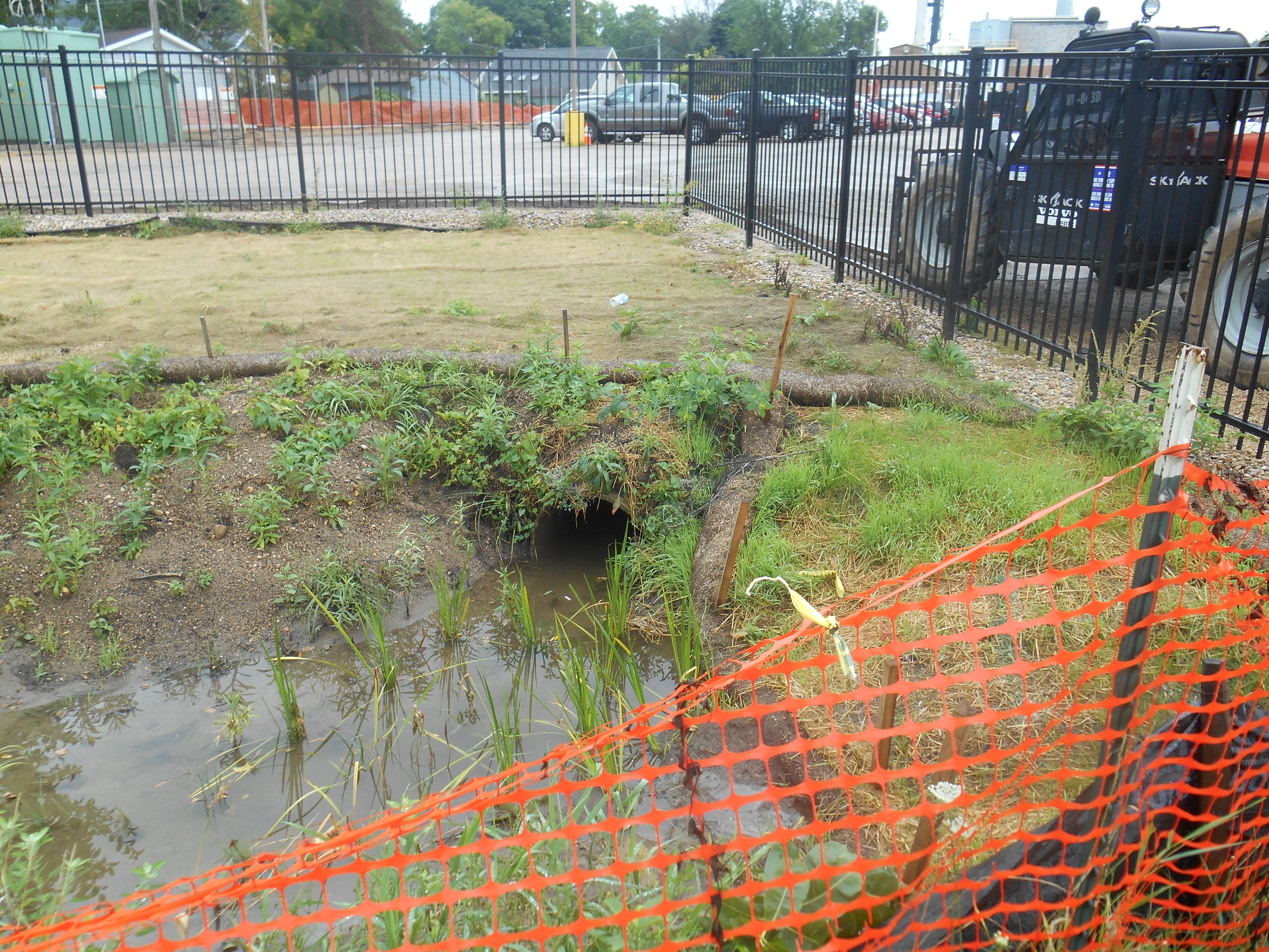
[1] We won’t bore anyone with the long convoluted story about the rather ridiculous means we had to resort to in order to get a specific answer to this question…
Of course, this one answer raises even more “unanswered questions” Here are some from MEJO and the community:
How deep is this storm drain?? When was it built? What has drained/dumped/leaked into it over the years? What drains into it now? In what condition is it? (e.g., how leaky is it?)
Did the DNR first obtain this 1994 storm sewer map from Kipp on June 16, 2014 (after MEJO asked repeatedly where the raingarden pipe came from)? Did they really not know about the route of this storm sewer drain before?
Why don’t any of the Arcadis reports to date depict this the full length of this storm sewer? (many reports don’t show it at all)
Why doesn’t Kipp have a more recent storm sewer map? Why doesn’t DNR ask them for one? Why did DNR not share this (or a more recent storm sewer map, if they have one) with MEJO, given that our repeated questions about the raingarden pipe’s origins led DNR to ask Kipp for the map in the first place? (MEJO eventually found the map in an open records request). What do they not want MEJO and the public to know?
Did DNR ever share this map with other agencies (DHS, PHMDC, EPA, city engineering) involved in assessing the PCB contamination in the backyards of the Waubesa St homes, Kipp raingarden contamination, and/or other Kipp pollution issues?
Could this storm drain have anything to do with the PCBs found in the backyards of the Waubesa homes (excavated May 20-June 27, 2013)?
Did the PCB contaminated soils in the backyards on Waubesa Street and along Kipp’s western edge wash down into the open ditch and storm drain into the raingarden before, during, and/or after excavation? (PCB contaminated soils from the Waubesa excavation were piled on the north parking lot for a while, which also drains into the raingarden).
If DNR knew about the route of this storm drain before June 2014 (e.g., before/during the investigations/excavations of the PCBs in the yards on Waubesa Street), why don’t any of the reports on the PCB investigations on Waubesa St, which include numerous maps of this area, depict it or mention it in any way?
Where were the PCB “base” and “wall” data points in Arcadis PCB reports relative to this storm drain, the catchment basins, etc?
Could the large catchment basin behind 233 Waubesa depicted in the Arcadis map be related to the relatively higher levels of PCBs found right about at that spot?
Why does the 1994 map not depict the sanitary sewer lateral that runs in between 253 and 257 Waubesa Street—see this map. Was this sanitary lateral built later? When? Might this lateral have anything to do with the higher levels of PCE vapor found in 253 Waubesa and 257 Waubesa St. homes (subslab vapor levels in these homes were much higher than other homes on Waubesa)?
There are many more questions….please send yours to info@mejo.us and we’ll add them.
