Photo: Excavations for new sewer line on county land north of Reindahl Park on October 10, 2019
The Madison Metropolitan Sewerage District (MMSD)–with permits from City of Madison and DNR–will discharge PFAS-contaminated groundwater water into Reindahl Park and Starkweather Creek for the next 3-6 months (possibly longer) as it builds a new sanitary sewer line on Madison’s northeast side. Dane County, which owns land the sewer line will go through, also approved the project.
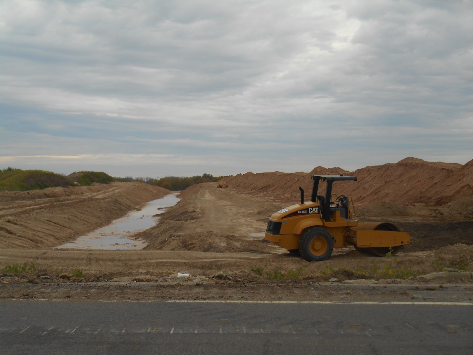
The excavation for the sewer line has already begun on county land north of the park (see photo above), and is scheduled to go through the park in November–right through shallow groundwater known to be contaminated with PFAS.
To keep shallow groundwater out of trenches excavated for the pipes, workers are “dewatering”—sucking up PFAS-contaminated shallow groundwater and releasing it onto grass and into ditches and stormdrains that route it to Starkweather Creek. Madison drinking water Well 15–shut down in spring 2019 due to concerning PFAS levels–is in the park very close to the new sewer line route, along with a large community garden, soccer and cricket fields, and a children’s splash pad and playground.
Sadly, also, the sewer line construction required the destruction of 40 mature trees in the park. People in the neighborhood worked hard to stop this killing of trees, but they were unsuccessful.
Now that these large trees have been cut down, excavations and dewatering through the park are about to begin. The October 10 photo below shows excavation equipment along the new sewer line, just 30-40 feet from the community gardens.

How much PFAS is under the park?
Levels of PFOS and PFOA (combined) measured in the groundwater under the park were 12.1 parts-per-trillion (ppt)–nearly the same levels found to date in Well 15 (11-12 ppt), which has been shut down due to the PFAS. See Reindahl PFAS report.
The total level of six PFAS found in Reindahl Park—PFOA and PFOS plus four other PFAS compounds– was 22.4 ppt. In Well 15, the total for these six compounds was 38.1 ppt. The maximum total to date for 10 PFAS compounds in Well is 56 ppt.
The PFAS testing in the park was very limited—just four borings along the line of the planned sewer route at relatively shallow depths (about 11-40 feet). Only six PFAS compounds were tested. This data is highly unlikely to reflect the full range of PFAS contamination levels horizontally and vertically under the park (and probably well beyond it).
While these PFAS levels are not as high as the super-high levels recently found in Starkweather Creek, they will be discharged continuously for months into the creek.
If tests were done more deeply and widely, and more PFAS compounds were measured, what PFAS levels would be found? As large volumes of contaminated groundwater are sucked up, what PFAS levels will be discharged into the park and creek? (Every liter of water discharged will have PFAS in it. How many liters will be discharged in six months–and what does this add up to? Has anyone done the math?) How will these PFAS discharges affect the already PFAS-contaminated Well 15 and creek?
We have repeatedly posed these questions to DNR officials in the last several months—but received no responses.
Photo below: Well 15 (building behind trees) adjacent to the sewer line excavations.

The high levels of PFAS in Starkweather Creek have likely been there for decades–and people who fish from Starkweather Creek have been eating PFAS all these years without knowing it. Why would the city and state allow any further discharges of PFAS into the creek–at any levels?
It’s time to stop all known PFAS sources to the creek. Government agencies certainly shouldn’t be permitting new PFAS discharges into it. This should be a no-brainer.
Where did the PFAS come from?
The most obvious source of the PFAS in Reindahl is the heavily contaminated Truax Air National Guard base, where a total of about 40,000 ppt of PFOA and PFOS—and 46,000 ppt for six PFAS–were found at hotspots on the west side/center of the base.
On the southeastern border of the Truax base, only about 2500 feet from Reindahl Park, combined PFOA and PFOS levels were 635 ppt; the total level of six PFAS compounds (the same ones measured at Reindahl) was 4,839 ppt.
PFAS Morass Map below–and link to map here.
Could the PFAS in the park be from the base? Truax ANG consultant reports and maps clearly show groundwater under the base moving to the southeast—the direction of the park and Well 15. There are also storm drains all around the base area that could drain into the park–a very large storm detention pond on the northwest corner of the park, near where PFAS was found, receives a lot of stormwater from these drains.
If the PFAS found in MMSD borings in Reindahl Park is from the Truax base, it would be the first PFAS groundwater data off the base other than the PFAS data from groundwater beneath the former Burke sewage treatment plant south of the base.
Another possibility is pesticides used on the sports fields in Reindahl Park and on land to the north leased to farmers by Dane County. PFAS are used in some pesticides. We have also asked the DNR and city to look into this, but they have not responded.
Perhaps the PFAS under the park came from a combination of sources: the Truax base, pesticides used in the park and adjacent farmland, and other sources in the area. Shouldn’t agencies look into it? Shouldn’t we identify these sources and work to remediate them?
PFAS data was gathered at citizens’ request—but not shared with them
In spring 2018, after learning about the new sewer line project, Greater Sandburg neighborhood residents asked that PFAS testing be done along the planned route.
To their credit, MMSD had the testing done. But when the tests came back showing significant levels of PFAS in groundwater along the planned route, they did not share the data with the neighborhood. Instead, they kept quiet and worked with DNR to get a permit that didn’t require treatment before dewatering in the park or, alternatively, require sending the water to the sewerage district for treatment. (See more about how this came to pass in Part 2).
The residents who asked for the testing, in fact, did not learn about the PFAS results until they were leaked to them after being found in an open records request in spring 2019. At that point, the sewer line plans were finalized and permitted, and the project was going forward through the contaminated zone.
When residents learned of the PFAS contamination and plans for destroying many mature trees, they were outraged and asked for a meeting. MMSD and the city quickly convened one with little notice. At the meeting, government officials assured residents that the PFAS levels were of no concern—no risk to people or the environment– and it was too late to change the plans so that fewer trees would be killed.
In sum, residents’ very legitimate concerns were deemed unimportant and ignored by MMSD, the city, and DNR. And now, the giant excavations for the sewer line are going forward, 40 trees have been cut down, and PFAS is being spewed into Starkweather Creek.
Part 2 (coming soon): Why did DNR and City of Madison permit these discharges of PFAS into Starkweather Creek? What does this have to do with current Republican-Democrat debates about PFAS legislation?
