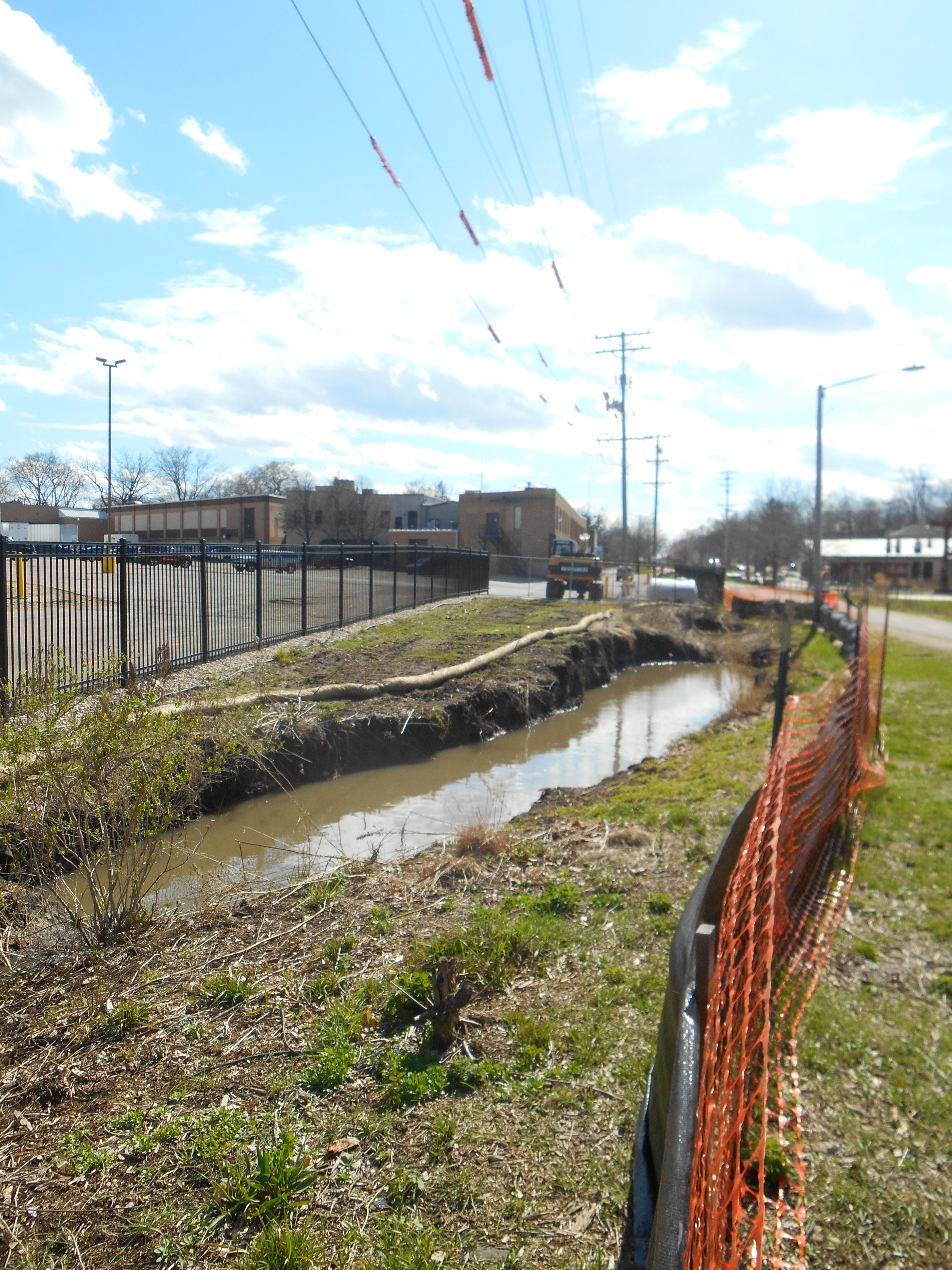
Yesterday we obtained a Figure from the City of Madison with more PCB data from soils excavated from the Kipp raingarden, on City of Madison property just north of Kipp, next to the public bike path and across from the Goodman Community Center. The PCB levels found around the edges of the former garden, now a toxic pit , are even higher than those reported in our previous post.
We don’t know exactly when these soils were excavated and tested, but the figure we have was dated April 22, 2014, Earth Day. The highest level— 85 ppm PCBs, orders of magnitude above both the residential direct contact RCL of .22 ppm and the industrial RCL of .74 ppm—were found on the north side of the raingarden, near the bike path, next to the raingarden sign.
These highly PCB contaminated soils are still there; in fact, we didn’t know it, but we were standing pretty much on the 85 ppm PCBs when we took many of our photos. The areas with the highest levels will be excavated, but MGE requires a 10-foot buffer for excavation around telephone poles, and other underground utilities also have to be avoided.
All around this excavation pit, children are playing and people are walking/biking. Goodman teen workers are putting food scraps in the compost piles just feet away. Though there is a flimsy short plastic fence around the garden, there are no signs anywhere to let people know that the area is a toxic soil excavation, with high levels of PCBs still remaining.
Questions this raises:
Why are there no signs anywhere around the excavation pit/pond to let people know what is being done and to alert them to the high PCB levels there?
How deep were these PCBs found? Why weren’t other contaminants besides PCBs (PCE, TCE, vinyl chloride, metals, dioxins) also tested in the 2nd round?
How long have the City, Public Health Madison Dane County, the Department of Health Services, the Department of Natural Resources (DNR), Kipp, and other government officials had this excavation PCB data? Did they plan to share it with the public? Why hadn’t they as of May 2 2014? Would anyone even know about the PCB contamination that remains there if we didn’t happen to ride our bikes past the excavation and if we hadn’t started asking questions?
Did the government entities listed above share this data and other details about the excavation with people in the nearby neighborhood, neighborhood association (SASYNA), Goodman Community Center, daycares, etc? Did they engage people in the neighborhood in discussions about how/when the excavation would occur, keep them apprised of the test results, and talk to them about the best ways to communicate with nearby residents and assure that children and pets do not play in and around the excavation area?
If the areas around the telephone poles and other utilities will not be excavated, will the PCBs in those soils remain in place indefinitely? These PCB hotspots are in highly-used public areas. Will there be signs alerting people about the PCB contamination there?
What is the long-term plan for this area? If the raingarden is rebuilt (as is planned, after more excavation) and continues to gather and concentrate PCBs and other contaminants—will the raingarden have to be excavated every few years to remove the high levels of contaminants? Is this really the best plan? What does the neighborhood want?
Is it really a good idea for Goodman to build a children’s SPLASH PAD just across the bikepath from this garden, very near where Kipp stored barrels of waste in the past on what is now Goodman property?
